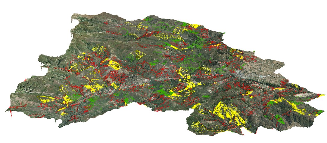
The main objective is to know the potential distribution of chestnut (Castanea sativa) in Castile and Leon through the use of spatial modelling tools based on 13 different variables. The aim has been to determine where the bioclimatic and geographical conditions are most suitable for the species to prosper. These models allow to evaluate in a quantitative way the possibility that a chestnut population occupies a specific area.
The chestnut tree is established in an area of approximately 28,419 ha in Castile and Leon (IFN3) and represents one of the most important multifunctional habitats in the region in terms of productivity and diversification of the produced values. Wood, biomass, chestnuts (food), mushrooms, landscape, biodiversity and culture are some of its features.
Therefore, the interest in chestnut orchards has been increasing in recent years and the interest in new plantations is a trend that is repeated in a context of constant change.
Modelling with Maxent has made it possible to identify the areas with the highest probability of development of the species. By modelling the potential distribution of Castanea sativa, it was obtained that approximately 93,000 ha are areas of optimal potential for the presence of chestnut, especially the area of El Bierzo and southern Salamanca, and approximately 361,000 ha are of intermediate potential in Castilla y León. The sensitivity of the model has resulted in a good rating (0.894 out of 1)
The development of this model allows for the adaptation of forest management plans, the conservation of existing orchards and the promotion of new growing areas. In this way, the future decisions of the farmers are supported with information that allows minimizing risks in future investment processes.
In the case of locations with optimum potential, the decision to plant chestnut trees is easier. However, in sub-optimal areas with lower productivity under normal growing conditions, it may be necessary to increase the investment by installing irrigation.
The main impacts are the obtaining of a cartography that allows us to identify the areas most likely for the implantation of the species with a productive objective. On the other side, as weaknesses, additional analyses must be carried out to validate the most successful territorial areas and include field work. Another weakness is the spatial resolution, which in smallholder areas may miss small details on the ground that make it difficult for the species to be established.
This type of model can be replicated in other species. In addition, the evaluation of the evolution of the impact of climate change on the geographical distribution of chestnut trees could be carried out, allowing the prediction of the advance of biological threats.
The inclusion of new variables related to biomass or the study of the fuel model can help to assess the risk of damage from anthropogenic conditions such as forest fires.
Rocio Gallego García, rocio.gallego@cesefor.com, www.cesefor.com
Roberto Rubio Gutiérrez, roberto.rubio@cesefor.com
Further information
Rocio Gallego García, Rocio.Gallego@cesefor.com, www.cesefor.com
Roberto Rubio Gutiérrez, Roberto.Rubio@cesefor.com, www.castanea.es , www.bioastanea.es
Elena Blanco Lago (Cesefor)

Rocio Gallego García
