Community-based agreement with the support of the government

Tempelhofer Feld development and maintenance plan - Berlin

English
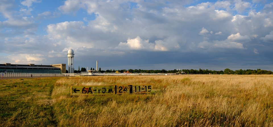
The development and maintenance plan for Tempelhofer Feld in Berlin (Germany) defines the guidelines, contents and measures for the the ca. 300 ha former airport, which is located in the center of the city and owned by the city itself. The 2016 plan was stipulated by the Law for the Preservation of the Tempelhofer Feld (ThFG, 2014) through a bottom-up process arising from a citizen vote. The plan was accordingly developed in a consensus-based participation process by the citizens of Berlin, the Senate Department for the Environment, Mobility, Consumer and Climate Protection and Grün Berlin GmbH. Measures include the preservation of meadows and their biodiversity, the establishment of community gardens and nature experience spaces, as well as leisure, recreational and art activities. The plan also provides rules for strengthening civic engagement and offers a framework for cooperation between citizens, local politics and administration, also known as the Tempelhofer Feld participation model. Elected citizens, representatives of the Senate Department for the Environment, Mobility, Consumer and Climate Protection and Grün Berlin GmbH work together on an ongoing basis in a monthly field coordination meeting (that is open to the public) aiming to jointly implement the plan and measures for the further development of the area. The cooperation to implement the plan is realised through a permanent three-column participation model consisting of a field forum, field coordination and thematic workshops (information and work meetings). In the field forum, which meets at least once a year and is also open to all interested parties, joint recommendations for further action are adopted. In order to implement the goals outlined in the plan, participatory planning processes are set up using the "Charter of Participation". One of the most important goals of the plan is to protect and further develop the unique open meadow landscape with its valuable flora and fauna and to preserve its urban climatic function.
Challenges addressed
  • Water management (e.g. reuse)
  • Green space management (e.g. accessibility)
  • Heat stress and heat island effect
  • Social cohesion
  • Social equity
  • Nature appropriation / stewardship
  • Reconnection to the biosphere / environmental education
  • Human health, comfort and well-being
Region:
EU
Country:
Germany
City:
Berlín
City population:
3,645,000
Timeline:
2016
Last updated:
26 Jul 2023

Participatory Budgeting in Cuenca

English
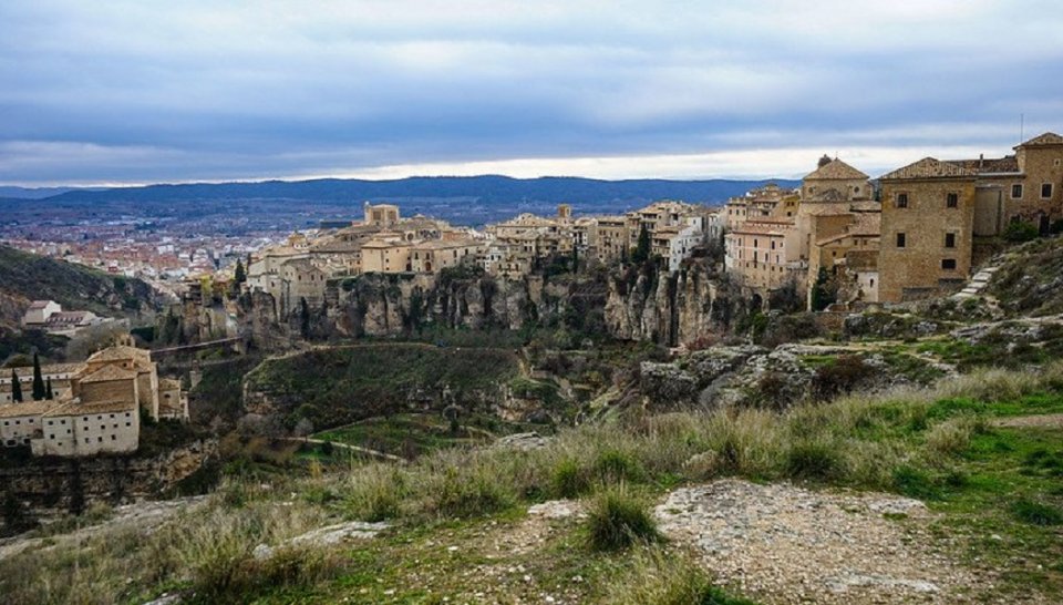
Participatory Budgeting is a cooperative instrument, a form of decision making which actively involves citizens in the spending of public resources. Cuenca counted between 2017 and 2019 693 Participatory Budget (PB) projects on an infra-municipal level with the aim to better include and benefit predefined deprived areas such as rural districts of regional or national cities. The Cuenca canton is divided into 15 urban and 21 rural parishes, a unique form of PB was introduced in its 21 rural parishes. There, PB processes make a significant contribution to climate change adaptation and mitigation. The area is severely affected with torrential rains leading to heavy flooding, thanks to PB, many massive water-related projects have been implemented and approved.
Challenges addressed
  • Ecologic connectivity
  • Soil quality
  • Water management (e.g. reuse)
  • Green space management (e.g. accessibility)
  • Flood risk: pluvial and fluvial / soil permeability
  • Landslide risk
  • Social cohesion
  • Social equity
  • Human health, comfort and well-being
Region:
CELAC
Country:
Ecuador
City:
Cantón Cuenca
City population:
614,539
Timeline:
2001
Last updated:
30 Aug 2023

Plan de desarrollo y mantenimiento de Templehofer Feld - Berlín

Spanish
El plan de desarrollo y mantenimiento de Tempelhofer Feld en Berlín (Alemania) define las directrices, contenidos y medidas para el antiguo aeropuerto de unas 300 hectáreas, situado en el centro de la ciudad y de propiedad municipal. 300 hectáreas, situado en el centro de la ciudad y propiedad municipal. El plan de 2016 fue estipulado por la Ley para la Preservación del Tempelhofer Feld (ThFG, 2014) mediante un proceso ascendente derivado de una votación ciudadana. En consecuencia, el plan se elaboró en un proceso de participación consensuado entre los ciudadanos de Berlín, el Departamento de Medio Ambiente, Movilidad, Consumo y Protección del Clima del Senado y Grün Berlin GmbH. Las medidas incluyen la preservación de los prados y su biodiversidad, la creación de jardines comunitarios y espacios de experiencia de la naturaleza, así como actividades de ocio, recreativas y artísticas. El plan también establece normas para reforzar el compromiso cívico y ofrece un marco de cooperación entre los ciudadanos, la política local y la administración, también conocido como modelo de participación Tempelhofer Feld. Los ciudadanos elegidos, los representantes del Departamento de Medio Ambiente, Movilidad, Consumo y Protección del Clima del Senado y Grün Berlin GmbH colaboran de forma permanente en una reunión mensual de coordinación sobre el terreno (abierta al público) con el objetivo de aplicar conjuntamente el plan y las medidas para el desarrollo ulterior de la zona. La cooperación para aplicar el plan se lleva a cabo mediante un modelo de participación permanente de tres columnas que consta de un foro sobre el terreno, una coordinación sobre el terreno y talleres temáticos (reuniones informativas y de trabajo). En el foro de campo, que se reúne al menos una vez al año y también está abierto a todas las partes interesadas, se adoptan recomendaciones conjuntas para futuras actuaciones. Para poner en práctica los objetivos marcados en el plan, se establecen procesos de planificación participativa utilizando la "Carta de Participación". Uno de los objetivos más importantes del plan es proteger y seguir desarrollando el paisaje único de pradera abierta, con su valiosa flora y fauna, y preservar su función climática urbana.
Challenges addressed
  • Water management (e.g. reuse)
  • Green space management (e.g. accessibility)
  • Heat stress and heat island effect
  • Social cohesion
  • Social equity
  • Nature appropriation / stewardship
  • Reconnection to the biosphere / environmental education
  • Human health, comfort and well-being
Region:
EU
Country:
Alemania
City:
Berlín
City population:
3,645,000
Timeline:
2016
Last updated:
26 Jul 2023
Presupuestos Participativos en Cuenca

Spanish
Los Presupuestos Participativos son un instrumento de cooperación, una forma de toma de decisiones que implica activamente a los ciudadanos en el gasto de los recursos públicos. Cuenca contabilizó entre 2017 y 2019 693 proyectos de Presupuestos Participativos (PP) a nivel inframunicipal con el objetivo de incluir y beneficiar mejor a zonas desfavorecidas predefinidas como distritos rurales de ciudades regionales o nacionales. El cantón Cuenca está dividido en 15 parroquias urbanas y 21 rurales, en sus 21 parroquias rurales se introdujo una forma única de PP. Allí, los procesos de PP contribuyen significativamente a la adaptación al cambio climático y a su mitigación. La zona se ve gravemente afectada por lluvias torrenciales que provocan grandes inundaciones; gracias al PP, se han ejecutado y aprobado numerosos proyectos de gran envergadura relacionados con el agua.
Challenges addressed
  • Ecologic connectivity
  • Soil quality
  • Water management (e.g. reuse)
  • Green space management (e.g. accessibility)
  • Flood risk: pluvial and fluvial / soil permeability
  • Landslide risk
  • Social cohesion
  • Social equity
  • Human health, comfort and well-being
Region:
CELAC
Country:
Ecuador
City:
Cantón Cuenca
City population:
614,539
Timeline:
2001
Last updated:
30 Aug 2023

Neighbourhood green plan - Utrecht

English
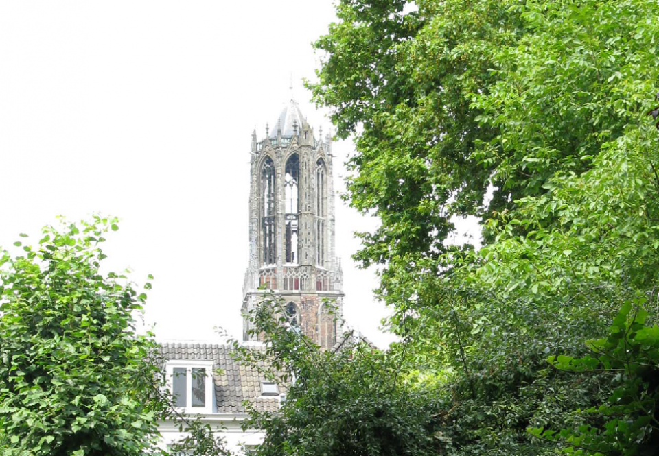
The ‘Wijkgroenplan binnenstad’ (inner city neighborhood green plan) is a community-based agreement that is part of a wider initiative by the municipality of Utrecht in the Netherlands to create neighborhood green plans for every area of the city. The neighborhood green plans are a collection of local greening projects, which were developed and selected in consultation with residents to create more, better and more accessible greenery in the inner city district through the implementation of nature-based solutions. The plan - which ran from 2014 to 2017 - emphasizes the structure of the inner city, which is characterized by a system of canals with wharves, the "singel" canal that surrounds the city centre, and various squares and courtyards. Greenery plays an important role in the inner city district, as it contributes strongly to the quality of life of the residents and the micro-climate.
Challenges addressed
  • Green space management (e.g. accessibility)
  • Air quality
  • Human health, comfort and well-being
Region:
EU
Country:
The Netherlands
City:
Utrecht
City population:
359,370
Timeline:
2014 to 2017
Last updated:
30 Aug 2023

Plan verde de barrio - Utrecht

Spanish
El "Wijkgroenplan binnenstad" (plan verde de barrio del centro de la ciudad) es un acuerdo comunitario que forma parte de una iniciativa más amplia del municipio de Utrecht (Países Bajos) para crear planes verdes de barrio en cada zona de la ciudad. Los planes verdes de barrio son un conjunto de proyectos locales de reverdecimiento, desarrollados y seleccionados en consulta con los residentes para crear más, mejor y más accesible vegetación en el distrito del centro de la ciudad mediante la aplicación de soluciones basadas en la naturaleza. El plan -que se desarrolló entre 2014 y 2017- hace hincapié en la estructura del centro de la ciudad, que se caracteriza por un sistema de canales con muelles, el canal "singel" que rodea el centro de la ciudad, y varias plazas y patios. La vegetación desempeña un papel importante en el distrito del centro de la ciudad, ya que contribuye en gran medida a la calidad de vida de los residentes y al microclima.
Challenges addressed
  • Green space management (e.g. accessibility)
  • Air quality
  • Human health, comfort and well-being
Region:
EU
Country:
Países Bajos
City:
Utrecht
City population:
359,370
Timeline:
2014 to 2017
Last updated:
30 Aug 2023

1000 Geveltuinen - Rotterdam

English
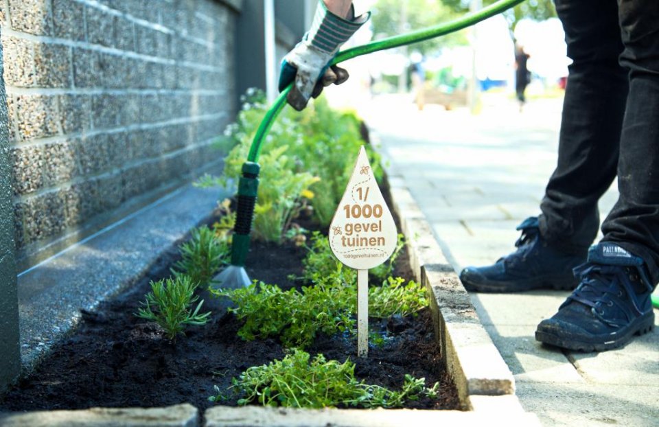
The campaign "1000 Geveltuinen" was launched in Rotterdam, the Netherlands in 2020 as a grassroots action to build 1000 facade gardens in the city. The action was a great success, quickly gaining media interest and receiving financial and substantive support from the local government. The project only took place from May 22nd 2020 (the day of biodiversity) to September 30th 2020, but its success convinced the city to take some long-term actions. The Municipality of Rotterdam started encouraging its inhabitants to take out concrete tiles from in front of their houses and to build facade gardens. Furthermore, the municipality created a manual and educational materials for its inhabitants. This grassroots action turned into a municipal programme, which engages people in creating green spaces in their nearest neighborhood helping the city to deal with challenges connected to climate change, such as urban heat island effects or local floods. This community-based agreement highlights the potential for collaboration between a municipality, NGOs and citizens.
Challenges addressed
  • Green space management (e.g. accessibility)
  • Flood risk: pluvial and fluvial / soil permeability
  • Heat stress and heat island effect
  • Social cohesion
  • Reconnection to the biosphere / environmental education
  • Human health, comfort and well-being
Region:
EU
Country:
The Netherlands
City:
Rotterdam
City population:
766,683
Timeline:
2020
Last updated:
30 Aug 2023

1000 Geveltuinen - Rotterdam

Spanish
La campaña "1000 Geveltuinen" se puso en marcha en Rotterdam (Países Bajos) en 2020 como una acción de base para construir 1000 jardines de fachada en la ciudad. La acción fue un gran éxito, ganando rápidamente el interés de los medios de comunicación y recibiendo apoyo financiero y sustantivo del gobierno local. El proyecto solo tuvo lugar desde el 22 de mayo de 2020 (el día de la biodiversidad) hasta el 30 de septiembre de 2020, pero su éxito convenció a la ciudad para emprender algunas acciones a largo plazo. El Ayuntamiento de Róterdam empezó a animar a sus habitantes a retirar las baldosas de hormigón de delante de sus casas y a construir jardines en las fachadas. Además, el municipio creó un manual y material educativo para sus habitantes. Esta acción de base se convirtió en un programa municipal, que involucra a la gente en la creación de espacios verdes en su barrio más cercano, ayudando a la ciudad a hacer frente a los retos relacionados con el cambio climático, como los efectos de la isla de calor urbana o las inundaciones locales. Este acuerdo comunitario pone de manifiesto el potencial de colaboración entre un municipio, las ONG y los ciudadanos.
Challenges addressed
  • Green space management (e.g. accessibility)
  • Flood risk: pluvial and fluvial / soil permeability
  • Heat stress and heat island effect
  • Social cohesion
  • Reconnection to the biosphere / environmental education
  • Human health, comfort and well-being
Region:
EU
Country:
Países Bajos
City:
Rotterdam
City population:
766,683
Timeline:
2020
Last updated:
30 Aug 2023

Restoration plan for the Angachilla Wetland in Valdivia ,Chile

English
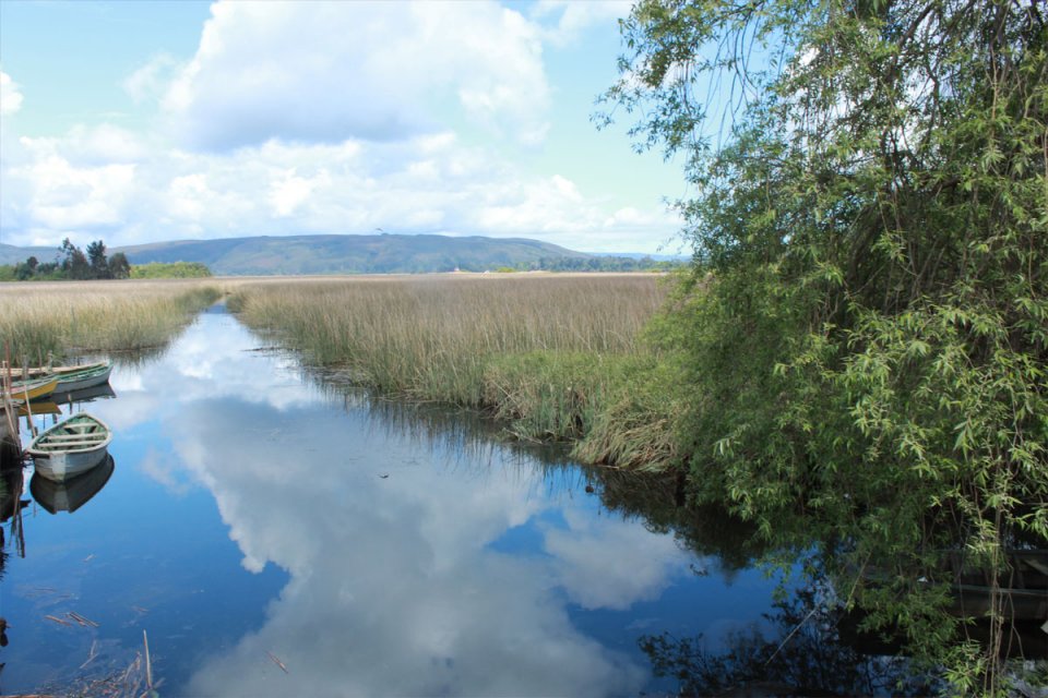
The Angachilla estuary wetland restoration plan was initiated by the community of neighbors in the municipality of Villa Claro de Luna, in Valdivia, Chile. The neighbors worked together with non-governmental organizations to restore the wetland, which has important ecosystem functions that directly benefit citizens. The actions began in 2007 and included cleanup, restoration and environmental education activities to recover a place that, abandoned and without any protection from the authorities, had been turned into a clandestine garbage dump. In 2015, as a result of the sustained work of the community the initiative obtained the support of the municipal government.
Challenges addressed
  • Soil quality
  • Green space management (e.g. accessibility)
  • Drought and fire risk
  • Flood risk: pluvial and fluvial / soil permeability
  • Heat stress and heat island effect
  • Social cohesion
  • Social equity
  • Nature appropriation / stewardship
  • Reconnection to the biosphere / environmental education
  • Human health, comfort and well-being
Region:
CELAC
Country:
Chile
City:
Valdivia
City population:
154,432
Timeline:
2007
Last updated:
30 Aug 2023

Plan de restauración del Humedal de Angachilla de Valdivia ,Chile

Spanish
El plan de restauración del humedal del estuario de Angachilla fue iniciado por la comunidad de vecinos del municipio de Villa Claro de Luna, en Valdivia, Chile. Los vecinos trabajaron junto con organizaciones no gubernamentales para restaurar el humedal, el cual cumple importantes funciones ecosistémicas que benefician directamente a los ciudadanos. Las acciones comenzaron en el 2007 e incluyeron la realización de actividades de limpieza, restauración y educación ambiental para recuperar un lugar que, abandonado y sin ningún tipo de protección por parte de las autoridades, fue convertido en un basurero clandestino. En el 2015, como resultado del trabajo sostenido de la comunidad la iniciativa obtuvo el apoyo del gobierno municipal.
Challenges addressed
  • Soil quality
  • Green space management (e.g. accessibility)
  • Drought and fire risk
  • Flood risk: pluvial and fluvial / soil permeability
  • Heat stress and heat island effect
  • Social cohesion
  • Social equity
  • Nature appropriation / stewardship
  • Reconnection to the biosphere / environmental education
  • Human health, comfort and well-being
Region:
CELAC
Country:
Chile
City:
Valdivia
City population:
154,432
Timeline:
2007
Last updated:
30 Aug 2023

Pages

Subscribe to Community-based agreement with the support of the government